
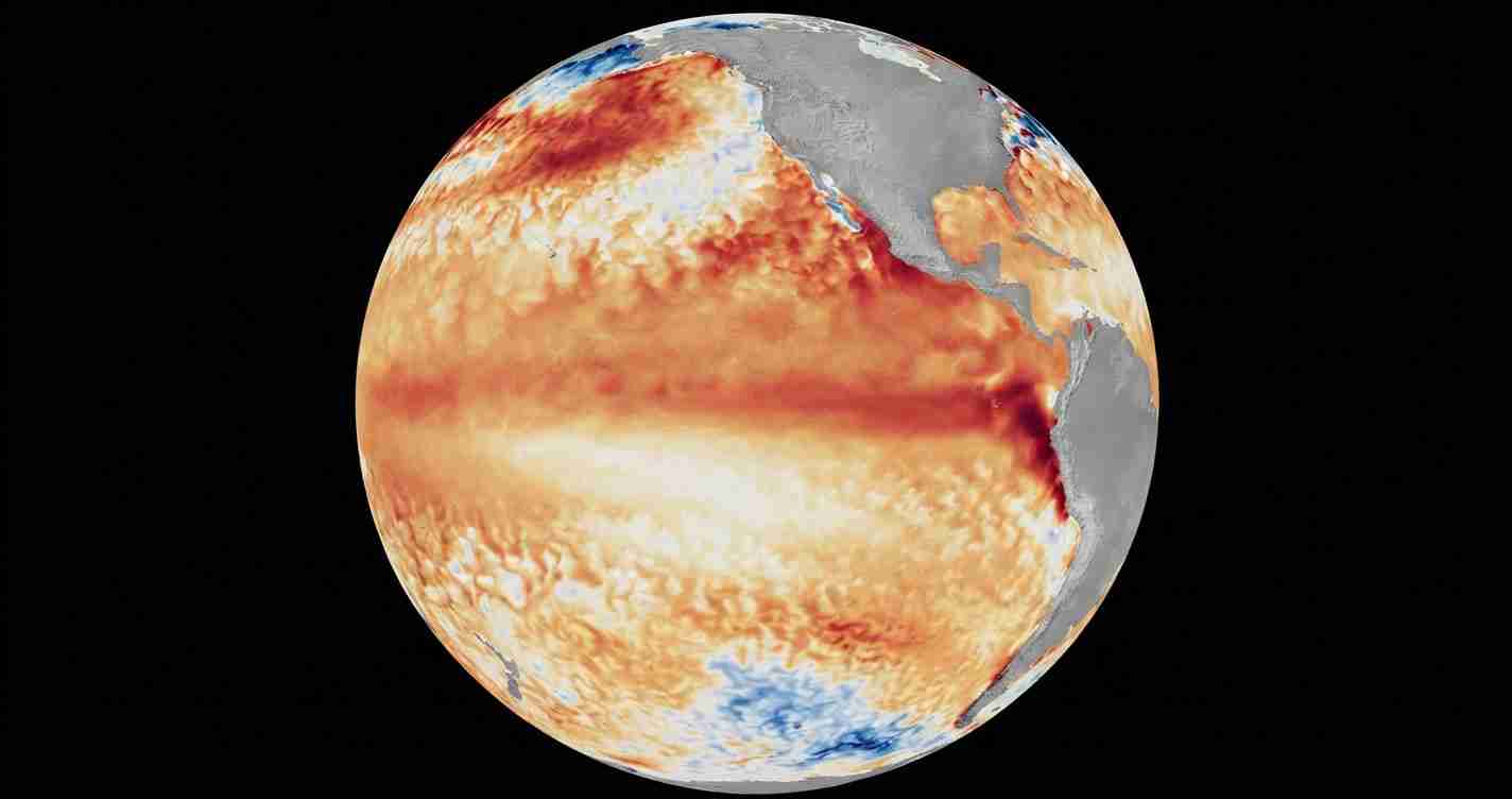
WASHINGTON, July 7 (San Diego News Online) — NOAA forecasters say El Niño is already underway in the tropical Pacific and is expected to strengthen into the Northern Hemisphere winter of 2026-27.
The Climate Prediction Center said in its June 11 ENSO Diagnostic Discussion that El Niño conditions are present and that its alert status is now an El Niño Advisory. For readers, the practical step is simple: keep an eye on NOAA’s seasonal outlooks if you live on the coast, plan winter travel, or depend on weather-sensitive work.
What NOAA is seeing
NOAA says the warming signal developed over the past month, with above-average sea surface temperatures across the central to eastern equatorial Pacific Ocean.
In its latest weekly report, the Climate Prediction Center listed the Niño-3.4 index at plus 0.7 degrees Celsius, the Niño-4 index at plus 0.7 degrees Celsius and the Niño-1+2 index at plus 2.1 degrees Celsius. Those are temperature measures NOAA uses to track whether the tropical Pacific is running warmer than average.
NOAA’s bulletin also points to its multimodel guidance, including the NCEP CFSv2, which it says favors further strengthening through winter. The agency said there is a 63% chance of a very strong El Niño during November-January, a level it says could rank among the biggest events in the historical record since 1950.
What is El Niño?
El Niño is one phase of the El Niño-Southern Oscillation, or ENSO, a natural pattern in the tropical Pacific Ocean and atmosphere.
During El Niño, surface waters in the central and eastern tropical Pacific become warmer than average. That warming can shift weather patterns far from the ocean itself. NOAA says the pattern can affect winter weather in the United States and can contribute to high-tide flooding in some coastal locations.
The key point is that El Niño is not a local storm or a hurricane by itself. It is a broad ocean-atmosphere pattern that can tilt the odds for temperature, rain and snow over months, not hours.
Why the forecast matters now
NOAA says the current El Niño is likely to strengthen during the Northern Hemisphere winter, which means forecasters will be watching whether it becomes moderate, strong or very strong.
That matters because stronger El Niño events can have bigger seasonal effects. NOAA’s Ocean Service says some U.S. locations could see more high-tide flooding when El Niño is in place. The agency’s weather education materials also say the pattern is a major driver of seasonal forecast changes.
For Washington readers, the forecast is mainly a national and coastal planning issue, not a local emergency bulletin. There is no specific El Niño warning for the District itself. But if you have travel plans, coastal property, or interests along the Mid-Atlantic or elsewhere on the coast, NOAA’s updates can help you track whether the pattern is intensifying.
How sure are forecasters?
Forecasts can differ a little because they use different models, time windows and ways of averaging the data.
NOAA’s Climate Prediction Center says El Niño is already present and should strengthen into winter 2026-27. The International Research Institute for Climate and Society at Columbia said El Niño conditions are strengthening across the tropical Pacific and are likely to keep intensifying.
Even with some differences in timing and strength, the main message from the official forecast is consistent: the tropical Pacific has moved into El Niño, and the odds favor a stronger event as winter approaches.
What readers should watch
The most useful updates will come from NOAA’s Climate Prediction Center, because it is the federal source issuing the advisory.
Watch for:
- the next ENSO Diagnostic Discussion from NOAA’s Climate Prediction Center;
- seasonal winter outlooks from NOAA;
- coastal flooding guidance from NOAA if you live near the water.
In short: El Niño is here, it is likely to strengthen, and NOAA says the highest-confidence forecast window to watch is November through January.
